! |
This page was created by User:Dragonleaf5678 |
Blithebeth is the 2nd most populous suburb of Avenir, England. As the city's largest subregion, it has a high population density, in addition to being the richest per capita, and most visited by tourists as of 2018. Blithebeth is the only suburb of Avenir also classified as a prefecture, with its own area capitol.
For its early history, Blithebeth was the quintessential "punching bag" of Avenir. All of its neighbours scrambled for its vast, open lands; Blithebeth, then known as Kingstanding, had no real allies to defend it, either. The duchy installed by the partitioning Buccleugh Dynasty was more of a puppet installation, as opposed to an independent principality, such as those installed in areas such as Blossom Hill. Throughout the 16th and 17th centuries, the majority of the land of modern Blithebeth was partitioned between Laving Hill, Ambrose Hill, and Buccleugh; its only independent lands were those existing in the modern iteration's centre and a thin line towards the village of Burbury (now in jurisdiction of Burbury, Avenir).
After Ambrose Hill was defeated in a series of campaigns versus Blossom Hill, most of Blithebeth's lands were now autonomous, although it now existed as a heavily-divided duchy. Irredentist former Ambrose Hill occupants stirred troubles and made the reigning duchy, which went by the name of the Kingstanding Dynasty, supremely weak. It was not until the Great War of the Southern Dukedoms' official geopolitical end, 1756, that Blithebeth developed into the economic juggernaut it is today. The generous Statute of the Union was signed in favour of Blithebeth, giving it material in reparations such as money, labour, and Werribee, potable land in its north-east extremity. Extremely cheap land plots in the expansive area made Blithebeth subject to a series of large-scale industrial developments, but the massive number of these occurring would lead to the Blithebeth Economic Crash of 1820. From this point onward, land plots were exponentially more expensive, leading to Blithebeth becoming the most expensive area in the country. Most developments onward were carried out by private enterprises, as such creating the overly-extravagant suburb in its modern day form.
History[]
Partition of Buccleugh[]
- Main article: Partition of Buccleugh
In the 15th century, the French aristocratic dynasty known as Buccleugh travelled to modern-day Avenir, and claimed much of the land under its own governance. It expanded dramatically into modern-day north Avenir, creating many different communities in the lands. This continued for years, until the money involved in sustaining such a prominent area became too difficult and exhaustive. As such, it partitioned into six different duchies (seven including itself), puppeted by the larger, Buccleugh duchy, and each new duchy was to be governed by one of six children of the Buccleugh Dynasty, five sons and one daughter. The massive, barren lands of modern-day Blithebeth were given to Kingstanding Buccleugh, who started the Kingstanding Dynasty.
As Kingstanding[]
Most puppets of the larger Buccleugh Dynasty totally broke off Buccleugh influence and eventually outstripped Buccleugh itself economically and geopolitically. Blithebeth, however, was an exception, remaining a backward satellite of Buccleugh throughout most of its years. It was constantly invaded, and its ample natural resources were liquidated by its neighbours, including Buccleugh. The duke/duchess of the Kingstanding Dynasty was forced to abdicate many times throughout these years. Its total surrounding meant development was extremely difficult, and no peasants or any people, for that matter, intended to move and develop Kingstanding.
Eventually, Kingstanding was reduced to an area of some 6km2, approximately one-fifth of modern-day Blithebeth's land area. By this time, its population was a meagre 4,000, and its economy destitute. The duchy resided elsewhere, in Blossom Hill. Most of its original lands were occupied by belligerent Ambrose Hill, who held most of the lands until around 1700, where it was beaten down by Blossom Hill who starved much of the population in a 17-year-long war. In order to increase its influence in the south, Blossom Hill — lead by military leader Jacob Hodgson — chose to impose an ultimatum on Laving Hill, Buccleugh, and Falsgrave: empty Kingstanding or face all-out-war. Blossom Hill, by far the strongest entity in Avenir, was successful; Kingstanding was able to rebuild at last. The Kingstanding Duchy returned in 1704.
Great War of the Southern Dukedoms[]
- Main article: Great War of the Southern Dukedoms
During the Great War of the Southern Dukedoms, Blithebeth was subject to Ambrose Hill onslaught once again. On August 4, 1728, Ambrose Hill issued an ultimatum to the Kingstanding Dynasty: join the Pro-Duchy cause, or back the Unionists, and face invasion. Despite Blossom Hill's promises to protect Kingstanding, the eastern portion of Kingstanding votes in favour of the Unionists, and is invaded by Ambrose Hill on April 18, 1728, who have virtually no casualties in the invasion. West Kingstanding, a historic Ambrose Hill territory, votes overwhelmingly for the Pro-Duchy cause.
Throughout the war, most of Kingstanding's Unionist population was treated poorly. Their houses were burned down in waves at the hands of the Pro-Duchy army. Agricultural plots were seized with no compensation and many were randomly slaughtered. West Kingstanding (i.e. the portion aligned to the Pro-Duchy) acted under the body of the Bellamy Dynasty, and was treated fairly by soldiers. West Kingstanding inhabitants were given East Kingstanding land plots. The alternate name for East Kingstanding, known as "Blithebeth" (named after Horace R. Blithebeth, military leader in the Unionist Army, who lead the Campaign for the Emancipation of Kingstanding, grandfather of Alfred Blithebeth), arises. Kingstanding Town, which went by its modern borders, splits from the rest of the area as a fully sovereign, and neutral, area.
On September 11, 1732, formerly-neutral Kingstanding Town is annexed by the Unionists, as the campaign for the Pro-Duchy in the south begins to collapse. On December 25, 1732, in the Christmas Day Assault, South Blithebeth is invaded by the Unionists. In the wake of this assault, a temporary truce is signed in the south. After some 5 years of occupation, by 1733, South Hampshire, a precinct of Kingstanding, its recovered by the Unionists. At this time, the war is at its volta, as Unionists slowly regain control. As the war in the south falls into stalemate, the war in the north (i.e. between Blossom Hill and Ambrose Hill directly) becomes its focal point. For another 3 years, Blithebeth and Kingstanding remain split under the control of the two adversaries, acting as a second war ground, behind the Free Zone. Some 40,000 men are killed on Blithebeth soil alone. However, as the war comes to an end, as Unionists begin to close in on Ambrose Hill, Kingstanding is emancipated in its entirety by July 29, 1736. Until the ceasefire on September 1, 1736, Kingstanding would be part of the greater "Southern Government", which included Laving Hill, Falsgrave, Buccleugh, Sutherland, Ambrose Hill Satellite (now Burbury), and semi-autonomous South Hampshire.
Statute of the Union[]
- Main article: Statute of the Union
The Statute of the Union, signed on September 1, 1756, was generous to Blithebeth. While there were minor concessions in the east, Blithebeth was given the land of Werribee, which composed part of the Ashfields as well as the tiny Werribee River and Lakeland, making it rich for agriculture. However, Blithebeth had to cede the village of Burbury, one of its two surviving population centres after 1736, to create the new suburb of Burbury out of the ashes of the Ambrose Hill Satellite, costing 14% of the population of the Blithebeth proper. Nevertheless, huge amounts of labour — the equivalent of 30 years' worth at the time — allowed for the construction and urbanisation of central Blithebeth, undermining the strength of Blithebeth's neighbours. By 1800, Blithebeth's population had overtaken that of Ambrose Hill (whose population shrank from some 100,000 to merely 32,000 on this date).
Industrial Revolution[]
The Industrial Revolution affected Blithebeth more than any other suburb of Avenir, profoundly so that its population went from 32,200 in 1800 to 277,481 in 1900. The greatest population increase was from 1888-89, where it went from 251,100 to 259,927 in the course of 12 months. The reason for this is Blithebeth's absurdly cheap land; by around 1810, most land plots were 92% cheaper than those in Ambrose Hill, and an excellent geographic position being tucked in the south, with links across the River Severn and its adjoining rivers connecting it to Blossom Hill and the north. Blithebeth was also an expanse of uniformly-flat land; given its historic foibles, Blithebeth probably would not have emerged as so developed because its land was so ripe for farming, but such process never occurred in its width, leaving massive swathes of quasi-untouched land.
Blithebeth Economic Crash of 1820[]

Blithebeth F.C. is the oldest football club in Avenir, joining the EFL the year after it was founded.
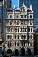
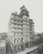
With the coming of industrial change and growth, it was of geopolitical course Blithebeth would see massive development. With acres of land being sold off each minute in the 1810s, Blithebeth lead to an economic crash in Avenir whereby the cost of living in the area exploded by some 800%, bankrupting developers until the explosion abated. Most land purchased by newcomers was sold off to richer landowners, typically undeveloped due to the explosion inhibiting urbanisation due to expenses. These landowners befit Blithebeth with ornate, state-of-the-art buildings, and as the area began to emerge as a modern centre, the tenants of these elaborate buildings were equally as opulent. Eventually, early era "skyscrapers" appeared in Blithebeth, of height above 100m, to make use of expensive and small land footprints.
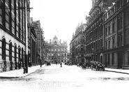
As Blithebeth developed, so did architectural interest in the area. In the 1880s, the period of major architectural overhaul in the area, Alfred Blithebeth — grandson of Horace R. Blithebeth, who emancipated Blithebeth during the Great War of the Southern Dukedoms — was personally assigned to the redevelopment of the precinctual area of West Blithebeth. Perhaps the only remnant of pre-Industrial Revolution era Blithebeth, this area was the last agricultural piece of the area — and having purchased some 5km2 of land, from 1876 to 1890 West Blithebeth became cemented as the centrepiece of not just the suburb, but perhaps all of Avenir, having overtaken Blossom Hill economically by this date. Alfred Blithebeth's masterplan included a totally cubic grid of buildings similar in height and width but idiosyncratic in the way they looked, each different from the last. Each street would be totally lined by trees, and important buildings such as town halls and churches would stand on the edge of a public square, where these grids would briefly break form. With Alfred Blithebeth's death in 1889, however, some "skyscrapers" began to emerge in West Blithebeth, as if to break the uniformity of the area. His meticulous planning, however, urbanised Blithebeth on an unprecedented scale, creating a gargantuan industry of building and housing in his legacy. Modern-day West Blithebeth, some 130 years old, remains a testament to its late creator.
Most of the Blithebeth area proper's infrastructure was owned by businesses at this time.
World War I and Interwar[]
During World War I, there was little change in Blithebeth. The few factories present in the area, mostly in the precinct of East Blithebeth, were instead occupied by the production of arms.
After World War I, Blithebeth saw a period of brief economic decline before recovering into full swing by 1920. Modern new estates, such as the new Kipper's Hall, were built as the area went into a period of normality. Art Deco architecture became apparent in West Blithebeth, and the new Business District was formed. Art Deco skyscrapers become fairly common in the Business District, comparable to Upper Manhattan. The Blithebeth Prefecture had its own loan of some $3,000,000 from the United States each month, which was mostly used in development as public services were covered by the city-wide monthly loan of $20,000,000.
The Great Depression caused a fast and severe end to this brief economic prosperity, however. Many construction sites from the 1920s emerged unfinished even until World War II. As the economic juggernaut of Avenir, Blithebeth experienced the Depression much harsher than any of its neighbours, seeing many international banks based in the suburb close down, and an ensuing collapse of labour force. Expensive apartments, on the rise since 1920, saw mass vacancies. The population declined, as did Blithebeth's main source of income: private development. This would not change throughout the 1930s.
Blithebeth sewer demolition[]

The sewage system which formerly ran beneath Blithebeth was fed into by the sewage of Laving Hill, Ashfield, Falsgrave, Pralcotte, Buccleugh, Rumensholme, Kingstanding Town, Sutherland, South Hampshire, Sisefield, Burbury, Ambrose Green, Falsgrave, itself, and even Ambrose Hill some 7 miles away, or the equivalent of some 1.7 million people. In the wake of World War I and thanks to the economic prosperity brought by the 1920s, a population explosion occurred in Avenir. With the sewage system becoming increasingly overused, eventually Blithebeth residents were reporting sewage-like water in their taps; this was because sewage ventricles had burst, releasing waste into open water supply. What ensued was a mass epidemic and freshwater drought in Blithebeth and also Ashfield, which also constituted part of the system, and so the entire system had to be rebuilt from scratch. Massive above-ground veins such as the ones in the thumbnail to the right were bulldozed.
In the absence of the system, temporary on-land water canisters, each capable of storing 400 gallons of water (1818l, 64,000oz). Most water was filtered from the River Severn and River Avon, and Lake Fishmarket was drained to roughly 60% of its original height in order to keep up with demands. The mass scale rebuilding was the largest systematic reconstruction effort in Europe.
World War II[]
At the beginning of World War II, Blithebeth's few factories, again, converted to munition production. Blithebeth had the lowest active military enrollment per capita; for every 100 men, only 30 were conscripted into war. This is because its mean age in 1939, 41, meant plenty of its residents were too old to see battle, or, regardless, too wealthy to participate.
Blithebeth was also a minor bomb target throughout World War II. While originally destined to see the devastation of carpet bombing, wrought in the 30-Day Blitz in Fishmarket and Holton, some 94 buildings in Blithebeth were reportedly damaged by Luftwaffe. Of these 94, the council reported, 48 were in fully reparable condition. 70 or so buildings that were bombed were later rebuilt.
Post-War[]
In the Post-War, Blithebeth, along with the City Centre, began to act as the city's new backbone — with an industrial shift occurring in the 1970s, old industrial areas like Fishmarket, Holton, Lorcombe, and Falsgrave became economically deficit. Historic areas like Ambrose Hill, Blossom Hill, Buccleugh, Cheselwicke, and even Blithebeth itself all converted their industries to tourism-centric ones, as opposed to a manufacturing one. Eastern Blithebeth, however, devoid of the west's heritage but also more economically useful, thanks to train lines, canals, the River Severn, and cheaper land, saw a massive rise in interest over the West, whose Rhadamanthine heritage laws prevented the demolition of older buildings in favour of newer, more business-friendly ones. So, businesses instead flocked to the eastern area, where old terraced neighbourhoods and industrial estates could be razed, and in their place new offices could be built. In 1959, the Business Quarter (not to be confused with the Business District) was carved out of West Blithebeth as a new precinct, still part of the West Blithebeth area code but different for two reasons: the heritage laws were far less strict, and the land far less developed. Skyscrapers, which were popularised in the 1920s in Blithebeth, met larger, more groundbreaking forms; the Head of the Blithebeth Prefecture Tower, which replaced its predecessor just adjacent, reached a height of 177m, and was completed in 1959, as arguably the first true "skyscraper" in Avenir. Sentinel Tower was built in 1971, reaching 180m tall, in the Business District. Not too later in 1979, the Equity Building (which reached 201m tall) was built on an old industrial estate in the Business Quarter, and just 2 years later in 1981, the Blithebeth Trade Centre was built, which reached 210m tall. New gentrification schemes occurred. In the 1990s, the warehouse district of Orton was totally redeveloped, with Avenir's largest shopping centre on a 3km2 site, incorporating older facets of the area with newer, public-friendly buildings. But perhaps Blithebeth's most iconic Post-War development was its 403m-tall Isosight Building, a rotunda topped by a 27m tall spire (making the architectural height 430m). This gigantic office building in the Business District , of some 85 floors, housed more than 40 high-profile businesses with an observation desk, with views across almost all of Blithebeth and some of its neighbours.
Demographics[]
The Blithebeth Ward (which includes its disputed territories) is a strong White British area and has been throughout history, with its current total of 80.2% increasing from the 2000 consensus of 78%. Blithebeth's statistics are fairly different to those of Avenir; in addition to having a higher share of a White British population, it has a higher overall birth rate of 2.11 children per women, the highest employment rate of 98.1% compared to the city-wide average of 92% (which peaked in the 1970s at 99% but has seen a decrease with the global economic shift, which affected industrial areas such as Holton), the highest percentage of men in its population, at 52% of the Blithebeth consensus, the highest marital population at 45% of the consensus, the most foreign-born people in jobs (with 96% of immigrants holding jobs), and the highest mean age, at 43.
Political[]
The Blithebeth Ward has seen a Conservative turnout every election since its foundation. This can be ascribed to a high number of permanent or long-standing residents, with many elderly residents having lived in Blithebeth for their entire lives, having upheld these views throughout their lifetime. A more privileged population — with 0.9% of Blithebeth's population enjoying access to free school meals — also equals more Conservative voters, especially with a small number of foreign-born over-18s and a very high average salary of £51,700 per year, some £15,000 above the national average.


